Shaping the future: Our strategy for research and innovation in humanitarian response.
Shaping the future: Our strategy for research and innovation in humanitarian response.
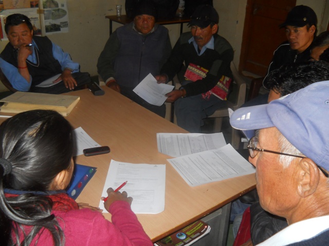
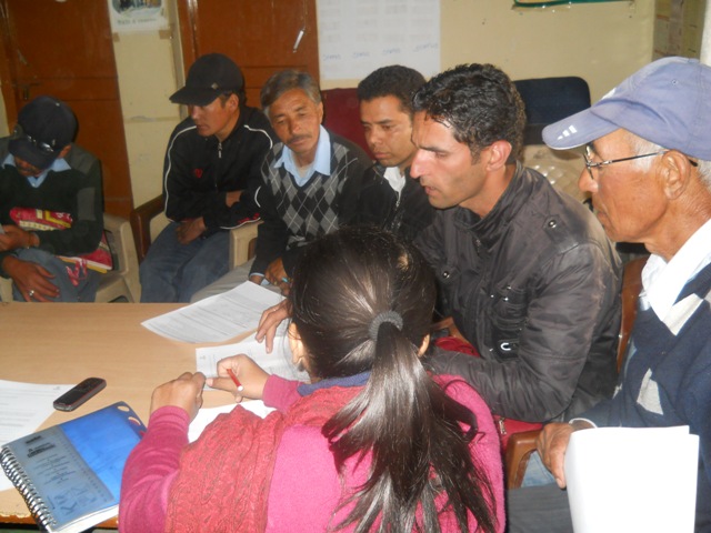
As a crucial step towards designing a Himalaya-adapted, indicator-based early warning system for region, the Pragya team has now geared up for the district level consultations. The team has put together structured discussion formats to identify top 5 hazards for each of the target eco-zones. The consultations are also designed to draw out natural hazard-indicators that might be available in traditional/local knowledge systems/customs/rituals. The series of interactions kicked off last week at Leh (state: Jammu & Kashmir) in the cold desert belt of the western Himalayas.
The consultations are designed as multi-stakeholder working group sessions, followed by presentations and deliberations. The programmes will be attended by Himalaya Experts/ Scientists from regional disaster management cells/research institutions, Local NGO/CSO Representatives, District Government representatives and local community members (representatives of local governance structures, women’s group members, other CBO members).
The impact of disasters and their frequency of occurrence for each natural hazard are rated independently. These ratings are then compared to determine the 5 hazards to which the community in the specific district is most vulnerable. The area-specific experience of the community along with the knowledge of the experts helps provide a rapid appraisal of the hazard and adaptive capacity scenario in the target areas. Apart from the frequency of occurrence and the extent of damage caused (explicitly laid down as rating scales), vulnerability assessment takes into account availability and knowledge of early warning systems, existence of traditional knowledge, capacity of the community to deal with the disasters, community awareness regarding the hazard, etc. Seven natural hazards are being assessed for each zone, namely Drought, Desertification, Avalanche, Landslide, Earthquake, Flood and Flashflood. Variations within different valleys and micro-catchments are also expected to be noted through the consultations. There are several indications from physical surroundings or movements/behaviours of living creatures (animals, birds, insects) that are connected to weather conditions, which in turn can help predict the hydro-meteorological disasters such as floods, cloudburst, avalanche etc. The interactions also seek to document such signs – observed and proven true in several occasions over the years in the target areas.
The daylong consultation held at Pragya’s Field Office in Leh, saw participation from scientists from 2 regional research institutes (representing SKUAST – Sher-E-Kashmir University of Agricultural Sciences & Technology, DIHAR – Defense Institute of High Altitude Research), 5 local and international NGO/CSOs (Rural Development & Youth – RDY, WWF, Ladakh Ecological Development Group – LEDeG, Ladakh Ecology and Health Organisation – LEHO, Leh Nutrition Project – LNP), community members from 15 villages in Leh including 2 nomadic settlements (pastoral nomads from Changthang belt of Ladakh). Representative of relevant district government departments (Command Area Development, Agriculture, Soil Conservation, DRDA – District Rural Development Agency) also stepped in to be part of the deliberation.
The discussions identified the rapid-onset disasters as major threats, which are characterized by the suddenness and acute intensity of the impacts during a short period. These events give people little or no time to react or evacuate. Earthquakes and flashfloods were rated as the most feared disasters as the community had nearly no knowledge of how to cope with them and the death and damage toll of the past event in Leh (August 2010) has been enormous. The experts present in the deliberation agreed that the fragility of the cold desert stretch of Leh has rendered it highly vulnerable to rapid onset disasters of hydrologic, meteorological and geological nature and the remoteness and inaccessibility of the region make the delivery of an effective and timely response, a challenge.
Preparations for other district level interactions are underway and we hope to bring in more updates from the various districts in a short while.
Subscribe to our newsletters....
SubscribeYou are seeing this because you are using a browser that is not supported. The Elrha website is built using modern technology and standards. We recommend upgrading your browser with one of the following to properly view our website:
Windows MacPlease note that this is not an exhaustive list of browsers. We also do not intend to recommend a particular manufacturer's browser over another's; only to suggest upgrading to a browser version that is compliant with current standards to give you the best and most secure browsing experience.