Shaping the future: Our strategy for research and innovation in humanitarian response.
Shaping the future: Our strategy for research and innovation in humanitarian response.
The aims for OpenDroneMap (ODM) in the context of the HIF are to make a useable, scalable, and fit for purpose tool for drone image processing for humanitarian and disaster preparedness scenarios. To this end, we are focusing on two parts of the project, what we can call core ODM and WebODM. For this post, we will focus on improvements to core ODM.
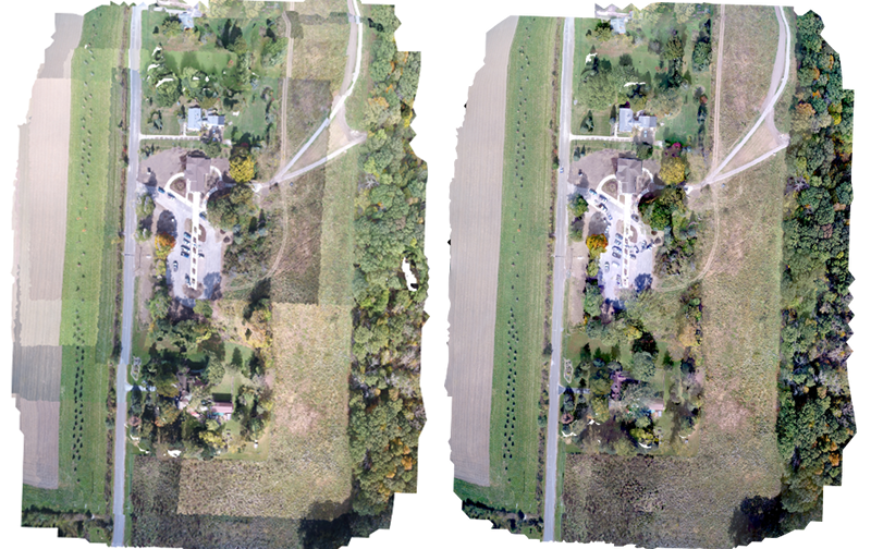
The feature photo above shows improved output texturing quality. The left image shows unimproved texturing. The right image shows improved texturing that smooths the differences between mosaicked images. Such improvements make image interpretation and classification much easier.
Core ODM has seen substantial improvements in its functionality and quality of outputs. For Q1, dense point cloud generation was targeted as the primary improvement. Existing code in ODM used two projects to create pseudo-dense point clouds: Clustering Views for Multi-view Stereo (CMVS), Patch-based Multi-view Stereo Software (PMVS). While both CMVS and PMVS were innovative and critical projects in their time we updated OpenDroneMap to use Open Structure from Motion (OpenSfM), a better performing, and maintained library.
This allows both for more dense, but also more accurate point cloud generation, with initial favorable comparisons with commercial closed-source software. As result of the work integrating dense matching from OpenSfM, we have already seen improved mesh generation, as well as improved quality of orthophoto outputs.
In addition to improved dense point cloud generation, improved mesh generation, and orthophotos, we have worked toward improved texturing and the integration of an external library to aid in user image classification.
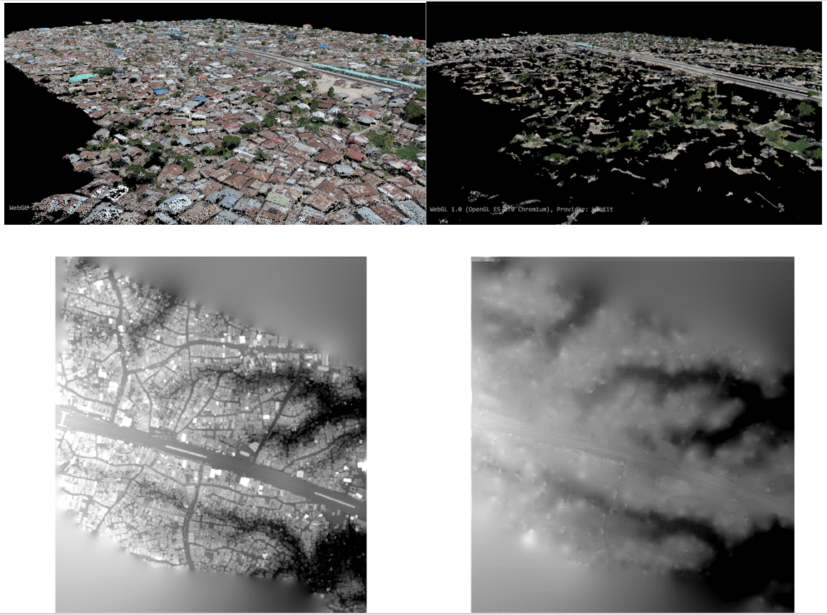
User image classification is underway with improved integration of the Point Data Abstraction Library (PDAL). PDAL has already demonstrated its utility in the use of OpenStreetMap data in providing digital terrain models in Dar es Salaam. We have begun tests of similar techniques in the context of the HIF to provide better data outputs from OpenDroneMap, as well as improved mesh modeling.
Figure 2 shows example PDAL outputs allowing user classifications to filter point clouds. This allows for the production of digital terrain models in addition to digital surface models. Digital terrain models provide the basis for hydrological modelling, and is an important tool in risk assessment, development suitability, and flood disaster response.
Subscribe to our newsletters....
SubscribeYou are seeing this because you are using a browser that is not supported. The Elrha website is built using modern technology and standards. We recommend upgrading your browser with one of the following to properly view our website:
Windows MacPlease note that this is not an exhaustive list of browsers. We also do not intend to recommend a particular manufacturer's browser over another's; only to suggest upgrading to a browser version that is compliant with current standards to give you the best and most secure browsing experience.